

Licensed Drone Videography In Manchester.
Broadcast-quality video production relies on precision, safety, and operational rigour. This is doubly true when capturing aerial visual assets for cinema and television. Professional drone videography in Manchester allows production teams to capture scale, motion, and striking urban perspectives across the city region. Operating unmanned aircraft in dense metropolitan environments demands strict compliance and disciplined risk management. Broadcast commissions require certified aerial teams who satisfy both creative treatments and statutory aviation standards.
Municipal permissions, Civil Aviation Authority rules, and congested city airspace create real operational friction on every commercial shoot. Production managers must balance ambitious visual treatments against public safety thresholds, flight restrictions, and tight schedules. How can executive producers secure fully compliant, broadcast-grade aerial cinematography across complex metropolitan locations without incurring delays or safety compromises?
Key Takeaways
- Commercial drone operations in urban airspace demand certified Civil Aviation Authority pilots, rigorous risk assessments, and location permissions to ensure complete safety and legal compliance.
- Dual-operator configurations separate flight controls from camera operation, enabling precise tracking shots, complex camera trajectories, and fluid visual compositions for broadcast television.
- Production teams must secure robust aviation insurance and public liability coverage while coordinating flight clearances near controlled airspace such as Manchester Airport boundaries.
- Matching aerial cinema camera profiles, colour spaces, and prime lenses with ground footage ensures complete visual consistency across high-end TV and film deliverables.
- Managing take-off zones, pedestrian safety cordons, and municipal film office permits prevents operational disruption and protects production schedules during high-profile urban drone shoots.
Operational Requirements for Urban Drone Filming
Aerial filming in dense environments demands close evaluation of statutory rules, operational logistics, and technical hardware. Production managers should review compliance parameters before deploying flight teams into live urban locations across Greater Manchester. This step preserves both safety and delivery certainty across the full shoot cycle.
The overview table below sets out essential operational parameters, safety controls, and technical requirements for common commercial aerial deployments. Reviewing these factors allows line producers to select the correct operational setup. They can then confirm the right regulatory approvals and insurance thresholds for high-end television, film, and infrastructure work.
| Deployment Category | Regulatory & Safety Requirements | Technical & Crew Configuration |
|---|---|---|
| Standard Urban Commercial | CAA GVC/A2 CofC certification, £5M Public Liability Insurance, site RAMS | Single or dual-operator setup, compact cinema UAV, 4K ProRes capture |
| Controlled Airspace / FRZ | CAA flight authorisation, ATC coordination, Manchester Airport clearance | Dual-operator rig, live telemetry monitoring, multi-band control links |
| High-Polish Cinema & TV | Operating Safety Case (OSC), emergency cordon, landowner access agreement | Heavy-lift UAV rig, full cinema camera package, dual-operator configuration |
| Infrastructure Inspection | TfGM / Network Rail clearance, strict isolation zones, asset owner sign-off | RTK GPS positional tracking, high-res optical zooms, thermal/visual sensors |
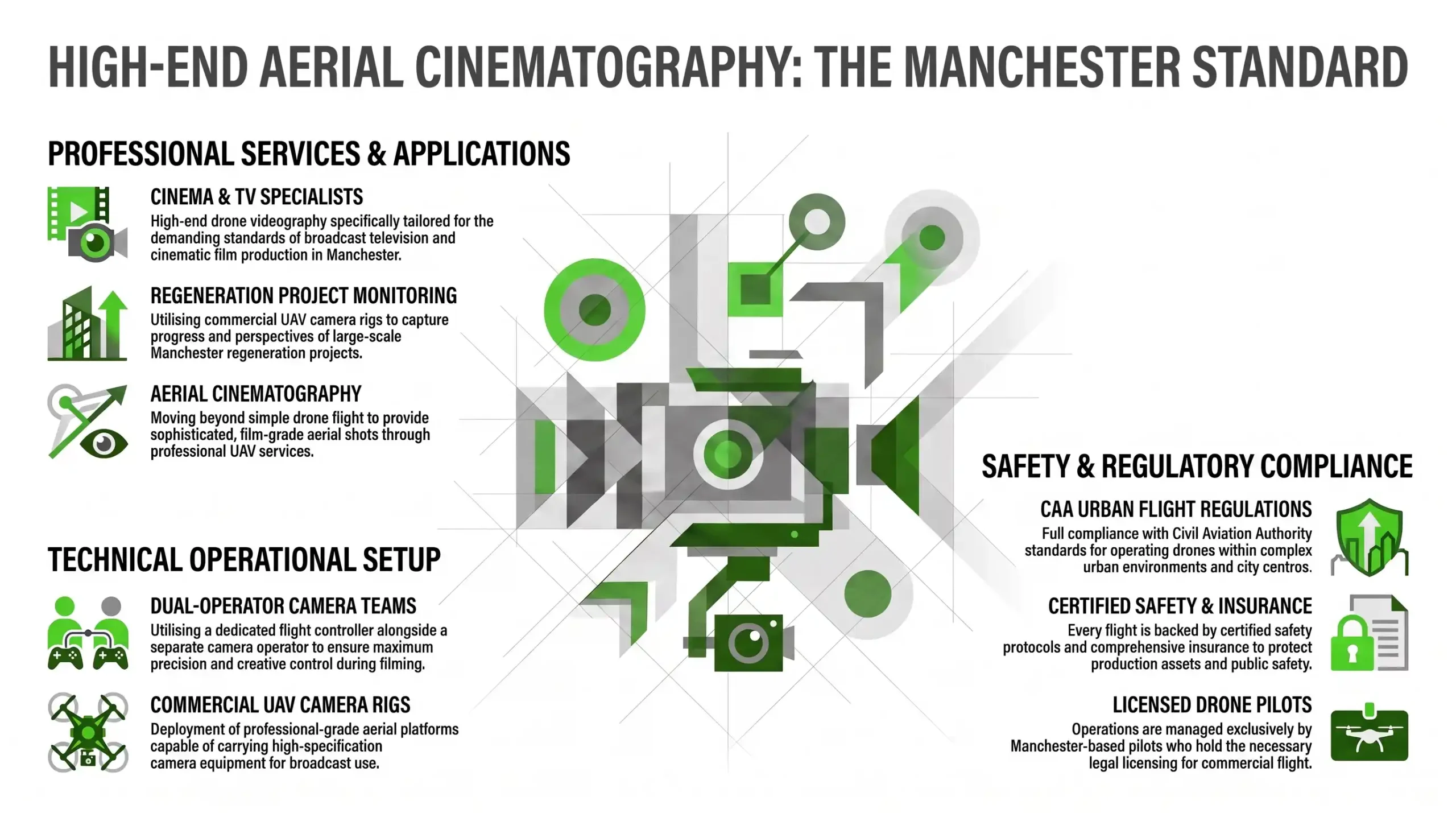
Civil Aviation Regulations for Urban Aerial Filming
Statutory Flying Limits in Populated Metropolitan Airspace
Commercial drone operations across Greater Manchester must follow Civil Aviation Authority safety regulations without exception. Operating unmanned aircraft in congested urban zones requires flight crews to maintain clear separation from uninvolved people, vehicles, and structures. Professional operators must hold appropriate pilot competency certifications to execute lawful commercial flights safely.
The UK legal framework for unmanned aircraft systems separates open and specific operational categories by risk. In densely populated areas of central Manchester, flying near buildings or crowds demands formal operational risk assessments or specific CAA authorisations. Professional agencies establish clear flight boundaries, maintain line-of-sight visual contact, and monitor airspace conditions throughout the shoot.
Submitting Risk Assessments to Municipal Authorities
Securing permissions for city-centre aerial filming involves structured applications to local authorities and film offices. Agencies must present detailed risk assessments, method statements, and flight maps showing take-off locations and emergency protocols. Screen Manchester reviews these submissions to confirm that planned flights will not disrupt public highways, council land, or local operations.
Municipal authorities require comprehensive documentation before granting location permissions for public land access. Submitting detailed site plans, emergency procedures, and evidence of public liability insurance establishes operational credibility. This formal review protects public safety and prevents unauthorised spatial obstruction. It also guarantees production teams can operate without last-minute intervention or police enforcement.
Business Video Production
Multi-Channel Asset Suites
At Paper Films, we produce cinematic, commercially-focused corporate video for businesses across the UK. From national manufacturers to specialist SMEs, we create content designed to deliver results across every channel your business uses. Build Trust. Strengthen Your Brand. Create Content That Works Harder.
Professional Flight Operations for Cinema and Television
Dual-Operator Configurations for Precision Camera Motion
Executing fluid aerial cinematography for television commercials and feature films requires a specialist dual-operator flight team. One dedicated pilot manages aircraft navigation, altitude, and airspace safety. An experienced camera operator controls gimbal pitch, yaw, roll, and focus. This division of duties allows complex visual tracking and precise lens framing on live sets.
Single-operator setups force a pilot to split focus between flight telemetry and creative framing, increasing risk and limiting visual complexity. By contrast, dual-operator rigs permit intricate dynamic movements. Pilots can orbit moving subjects or weave through architecture whilst maintaining absolute aircraft control. This division of responsibility keeps camera moves precise, repeatable, and broadcast-ready.
Coordinating Ground Crews and Aerial Flight Teams
Integrating UAV services smoothly into broadcast environments requires direct communication between drone operators, line producers, and ground crews. Dedicated wireless headsets enable real-time coordination between the pilot, camera operator, and director. Establishing clear call-outs before take-off ensures everyone on set understands flight paths, safety buffers, and shot objectives on the day.
Effective communication prevents set delays and eliminates safety risks when operating near ground units. Briefing the assistant directors, safety marshals, and talent on flight timing allows ground actions to sync with overhead moves. This structured approach maintains set discipline, protects working personnel, and maximises valuable shoot windows.
Corporate & Brand
Strategic Storytelling
We craft intelligent brand documentaries and corporate films for global organisations. Moving beyond standard interviews, we use authentic, broadcast-quality storytelling to communicate complex values to investors, stakeholders, and internal teams.
Risk Management and Airspace Clearances
Aviation Public Liability Limits and Risk Assessments
Commercial aerial video production demands robust public liability insurance tailored to aviation activities. Standard corporate production insurance typically excludes drone operations, requiring dedicated commercial UAV policies. Municipal authorities and corporate clients usually specify minimum cover thresholds of five million pounds. This mitigates potential property damage and third-party injury risks on complex shoots.
Before any flight takes place, certified operators complete thorough Risk Assessment and Method Statement (RAMS) documents. These evaluations identify potential hazards such as overhead power lines, tall structures, radio frequency interference, and pedestrian flow. Establishing physical exclusion zones and contingency protocols ensures operational risks are controlled effectively before launch.
Flight Restriction Zones and Regional Airport Airspace
Operating drones near aviation infrastructure requires precise airspace coordination and formal clearance protocols. Parts of Greater Manchester fall within controlled airspace or Flight Restriction Zones, notably around Manchester Airport and regional aerodromes. Filming within these protected zones requires advance notifications and direct authorisation from Air Traffic Control units.
Failing to secure proper airspace clearance can result in severe legal penalties and immediate operational shutdowns. Professional drone operators rely on digital airspace charts and live flight telemetry to monitor surrounding air traffic. Direct communication with local control towers ensures commercial drone flights proceed safely without compromising manned aviation operations.
Commercial Advertising
Cinematic & High-Impact
We produce high-gloss TV commercials and digital campaigns designed to captivate and convert. Our team manages the entire creative journey, from storyboard to broadcast, ensuring your brand message is delivered with world-class production values that cut through the noise.
High-Specification Cameras and Colour Matching
Integrating Cinema Camera Payloads on Heavy-Lift Drones
Capturing broadcast-quality footage requires high-specification camera payloads mounted on heavy-lift drone rigs. Professional UAV systems carry industry-standard cinema cameras capable of recording 4K or 6K RAW formats with wide dynamic range. Using prime lenses and remote focus gear yields visual fidelity that matches main unit ground cameras cleanly.
Mounting heavy camera packages on specialist multi-rotor drones demands balanced gimbal stabilisation and high-torque motors. These cinema-grade payloads handle rapid movement and adverse wind conditions while maintaining rock-solid visual stabilisation. The resulting imagery offers the sharpness, bit-rate, and exposure latitude expected by modern television networks and cinematic distributors.
Matching Aerial Visual Assets with Ground Footage Profiles
Maintaining visual continuity across a film or television project requires aligning aerial image profiles with ground footage setups. Experienced drone crews record using identical log colour profiles, sensor settings, and shutter angles as the ground team. This technical alignment prevents jarring visual breaks when cutting between overhead and ground angles.
During post-production, colourists apply unified Look-Up Tables (LUTs) across all footage sources. Precise sensor calibration ensures natural skin tones, consistent contrast, and uniform colour accuracy throughout the sequence. This rigorous workflow elevates production value. Aerial shots feel integrated into the visual narrative rather than looking like isolated cutaways.
Production Support
Regional Crew & Logistics
We act as a trusted “boots on the ground” partner for international agencies and broadcasters filming in the North. We provide elite-level crew hire, location logistics, and technical support to ensure your UK production runs seamlessly.
Location Access and Spatial Logistics Across Manchester
Securing Private Landowner Take-Off and Landing Approvals
Civil Aviation Authority regulations require drone operators to obtain explicit permission from property owners for take-off and landing points. Council filming permits cover public spaces, but private buildings, commercial developments, and transport hubs require separate landowner agreements. Securing written access rights protects productions from legal disputes and property access issues.
Location managers must identify suitable launch zones offering clear lines of sight, secure perimeters, and stable surface conditions. Negotiating access agreements early in pre-production guarantees reliable operational bases during shoot days. Written permissions also clarify site safety rules, security access steps, and property release rights required for commercial distribution.
Public Safety Controls in High-Footfall City Locations
Filming aerial sequences in busy urban environments requires physical safety controls to protect pedestrians and road traffic. Deployment teams erect safety cordons, signposts, and warning notices around launch pads to prevent public access. Trained location marshals manage foot traffic and maintain safe separation distances while aircraft are airborne overhead.
In high-density areas like St Peter’s Square or Spinningfields, timing operations during low-footfall periods reduces safety risks. Early morning schedules allow crews to capture expansive city perspectives with minimal pedestrian traffic. Setting clear physical buffers and working closely with local security personnel protects the public and preserves production efficiency.
Did You Know?
Under Civil Aviation Authority regulations, operating commercial drones within controlled airspace or a designated Flight Restriction Zone near an airport requires formal air traffic control clearance. This applies regardless of landowner permission or municipal filming permits.
Sector Applications in Regeneration and Infrastructure
Progress Tracking for Large-Scale Regeneration Schemes
Aerial drone filming plays a vital role in documenting large-scale urban regeneration, civil engineering, and housing developments. High-resolution aerial perspectives capture site progression, structural developments, and geographic scale far more effectively than ground-based videography. Public sector clients and developers rely on these visual updates for stakeholder briefings and investor presentations.
Pre-programmed GPS flight paths allow drone operators to capture identical aerial trajectories across multi-year construction lifecycles. These precise visual matches enable time-lapse comparisons and progress edits that showcase development milestones clearly. The resulting media assets provide powerful visual evidence for corporate accountability, funding updates, and marketing campaigns.
Cinematic Visuals for Regional Place-Making Campaigns
Place-making and regional marketing initiatives rely on engaging visual assets to showcase cities, heritage sites, and commercial districts. Professional UAV services deliver sweeping wide shots, low-altitude reveals, and architectural passes highlighting Manchester’s changing skyline. These dynamic visuals help tourism boards, local councils, and commercial agencies attract investment and visitors.
Combining smooth aerial camera moves with golden-hour daylight creates high-impact marketing assets for place-branding campaigns. Aerial views connect individual architectural landmarks with surrounding green spaces, transport networks, and commercial hubs. This comprehensive spatial framing gives prospective investors and national audiences a clear appreciation of regional development and economic vitality.
Post-Production Workflows and Technical Data Management
On-Site Data Management for High-Bitrate Media Ingestion
High-resolution drone videography generates massive volumes of high-bitrate media files that require immediate on-site management. Data wranglers back up raw camera cards onto redundant storage drives using verified checksum software before clearing media for reuse. This strict data protocol prevents corrupt files, lost take logs, or data loss during production shifts.
Commercial shoots often capture heavy ProRes or RAW footage formats that demand organised media management systems. Labelling clip files with precise metadata, flight logs, and camera details allows edit teams to integrate aerial footage smoothly into post-production timelines. Immediate off-set backups protect valuable media assets and support smooth post-production workflows.
Motion Tracking and Visual Effects Alignment in Post-Production
Integrating 3D motion graphics, visual effects, or future architectural CGI models into aerial footage requires accurate post-production tracking. Post teams use specialist tracking software to extract camera movement data from high-resolution drone plates. This spatial data allows visual effects artists to anchor digital assets precisely into live-action aerial shots.
Smooth, stable aerial movement recorded with precise camera telemetry simplifies match-moving and 3D integration in post-production. Visualising unbuilt infrastructure, planned regeneration schemes, or animated graphical overlays directly on real aerial footage creates convincing visual representations. High-end visual effects alignment bridges creative vision with commercial communication for complex corporate and municipal briefs.
Talk to Us About Your Project
If your business is looking for a strategic video production partner to support marketing, recruitment, communications or brand growth, we’d like to hear about your project.
We work with businesses at every scale — from single flagship films to ongoing content partnerships. Every conversation starts with understanding your objectives, not selling you a package.
Final Thoughts
Professional drone videography in Manchester offers television networks, film studios, and commercial enterprises a strong tool for capturing dynamic urban perspectives and architectural scale. Achieving broadcast-grade visual quality requires more than high-spec camera hardware. It demands meticulous pre-production planning, strict CAA compliance, and experienced flight crews. By prioritising safety, securing comprehensive permissions, and deploying dual-operator setups, production teams can capture ambitious aerial visual assets while eliminating legal and operational risks.
As urban environments continue to evolve and airspace regulations become increasingly refined, working with certified, commercially accountable aerial production partners remains essential. Integrating licensed drone operations early into project planning safeguards production budgets and streamlines municipal approvals. It also ensures seamless visual continuity across ground and aerial units. High-standard aerial cinematography elevates commercial storytelling and delivers lasting value for national brands, public infrastructure projects, and cinematic productions.
Frequently Asked Questions
A:
Commercial drone filming in the UK requires operators to be registered with the Civil Aviation Authority. Pilots must also hold appropriate competency certificates, such as a General Visual Line of Sight Certificate (GVC) or A2 Certificate of Competence (A2 CofC). In dense urban areas like Manchester, operations close to buildings or crowds may require specific CAA operational authorisations. Licensed drone pilots must also conduct formal risk assessments and secure location-specific take-off permissions before launching any flight.
A:
Yes. Commercial aerial filming on council-owned land, public parks, or public highways in Manchester requires permission coordinated through Screen Manchester. Submitting a permit application requires proof of specialist aviation public liability insurance, a comprehensive Risk Assessment and Method Statement (RAMS), and precise flight maps. CAA rules govern airspace safety. However, landowner access and public safety permissions on the ground must be formally granted by municipal authorities before filming begins.
A:
Dual-operator setups use two specialist crew members working simultaneously. One certified pilot is dedicated entirely to aircraft navigation and safety. A camera operator controls camera pan, tilt, focus, and framing. Splitting these responsibilities allows the camera operator to execute smooth tracking moves, rapid framing adjustments, and fluid visual reveals without compromising aircraft safety. This configuration produces higher visual precision and broadcast-quality footage suitable for high-end TV and film.
A:
Yes, but flying within controlled airspace or designated Flight Restriction Zones (FRZs) around airports requires formal Air Traffic Control (ATC) authorisation. Drone operators must submit flight plans in advance and establish direct communication channels with control towers. They must also adhere strictly to granted flight windows and altitude caps. Certified commercial drone pilots regularly manage these airspace clearances to execute legal, safe aerial filming within restricted zones across Greater Manchester.
A:
Commercial drone videography requires specialist aviation public liability insurance. Standard corporate video production policies specifically exclude unmanned aircraft operations. Most local councils, film offices, and enterprise clients specify minimum cover limits of £5 million. Larger infrastructure or high-footfall city centre projects usually require £10 million cover. Valid insurance documentation must be submitted alongside site risk assessments when applying for municipal filming permits or landowner approvals.
drone videography in Manchester
Manchester drone videography
drone videography in Manchester
Manchester drone videography
drone videography in Manchester
About The Author
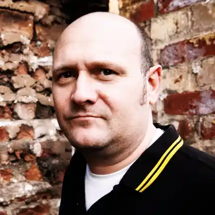
Daniel founded Paper Films in Manchester over twenty years ago and continues to direct on every flagship project. He has built a reputation for translating complex B2B propositions into cinematic, commercially-focused films for organisations including BCN, Lancaster City Council and BAE Systems. Daniel’s direct involvement is built into every brief — strategy, scripting, on-set direction and final edit — so the work never passes to a junior team.
